Laser scanning is fast becoming part of the everyday surveying workflow. The information collected in the form of a point cloud is highly accurate. Laser scanning can be used to produce accurate as built drawings, topographic maps and form the basis of digitally modelling the as built environment. We at DTM Technologies have developed workflows and strategies that can manipulate point cloud data and create visualisation products suitable for the surveyor, the architect, the scientist, the planner, the environmentalist, the archaeologist, the list is endless. We have the equipment, we have the skills. To hire our scanning services and/or our skills, give us a call or contact us here and lets talk.
LET US CALL YOU

Laser Scanning
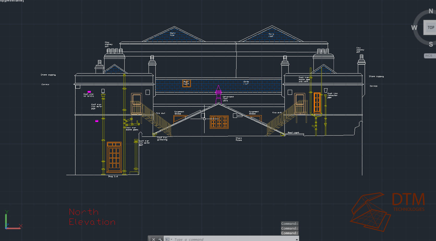
Captured in 1 day with 22 scan locations in and around the church. Laser scanning and surveying provide a full and accurate real world 3d point cloud/model ( 75 million points in this case) with an accuracy <5mm. The point cloud provides all the necessary information for planners, architects and engineers to analyse the building without leaving the office. Accurate 2d drawings, 3d models and all measurement and location information can be derived from the point cloud.
Laser scan data.
Laser scanning and surveying will soon be part of a larger process of recording, planning and building within the Uk. laser scanning captures, as is, real world data accurately. Our background is 3d Modelling and puts us in an ideal place for providing this data along with associated value services, including building information modelling, visualisations and measured drawing in a way that can benefit our clients 2 fold, planning, design & construction as well as visualisations for consultations, public and private.

Heritage
Laser scanning is ideal for real world recording, its fast and extremely accurate. Measurements, linear, area and volume can be calculated from the data. Non invasive methods like laser scanning are ideal at sites of historic importance. Animations and visualisations can be created from the data, these can be ideal for education and promotional material.


DTM-Technologies specialise in digitally reproducing the world around us, accurately and at high resolution. We provide aerial survey, photography and film as well as land based scanning. Our deliverables are tailor made for our clients needs, interactive 3d applications, animations, point cloud and meshes. Survey grade data or simply for visualisation purposes, we aim to provide whatever you require.